 Lords
Worship
People
Places
People
Contact
Lords
Worship
People
Places
People
Contact
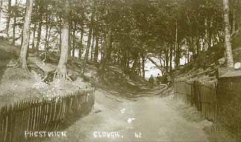
Prestwich Clough and St Mary's Flower Park
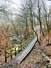
The Park acts as a Green Gateway between the urban housing of Prestwich and the semi-rural landscape of the Irwell Valley. From the Park you can walk to St Mary's Church, and continue down through Prestwich Clough. At the far end of the Clough you can turn Left to head to Drinkwater Park and on towards Kersal Wetlands and the Cliff, or head into Waterdale and turn right to reach the Thirteen Arches, Philips Park, or further out to Clifton Country Park, Prestolee and beyond. Here are some pages showing local walks and heritage of the Clough and it's surroundings, or scroll down to read about the Flower Park.
Prestwich Cloughs Walk :
Walk taking in Prestwich Clough & Mere Clough
Prestwich Clough Heritage Trail :
Web App Guide to the numbered posts in Prestwich Clough (with photos)
Prestwich Clough Heritage Trail :
Document Guide to the numbered posts in Prestwich Clough (with photos)
Clough Tea Rooms:
The Old Tea Rooms
Clough Lane :
Article covering Clough Lane.
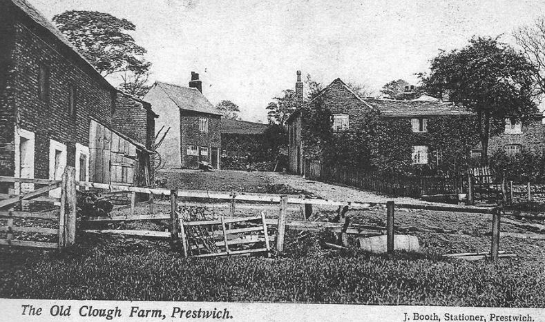
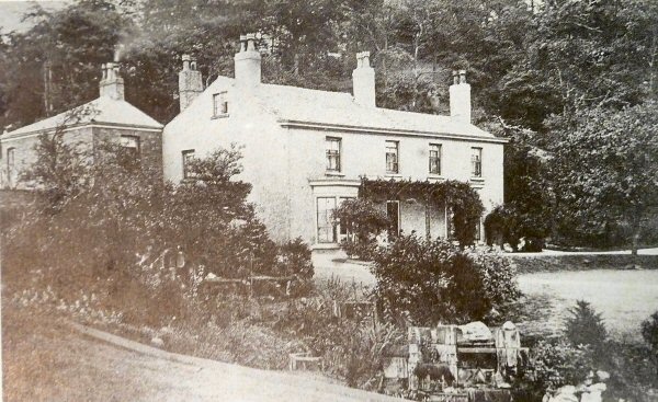
Prestwich Clough (House) :
Article covering Buckley Bleachworks and Prestwich Clough (House)
A brief history:
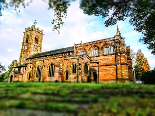
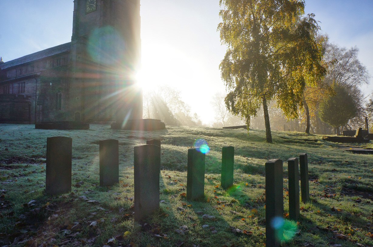
St Mary's Church :
A brief History for visitors to Prestwich Parish Church.
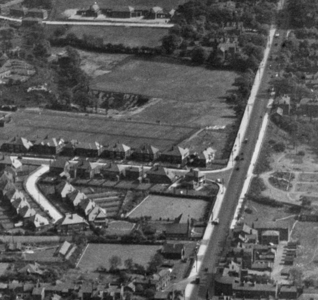
The previous 15 years had seen the population of Prestwich grow from 17,612 in 1915 to 23,881 by 1931, and great housing estates had begun to spread over the previously semi rural land which had provided luxurious homes for the successful merchants and industrialists of nearby Manchester during the Industrial Revolution.
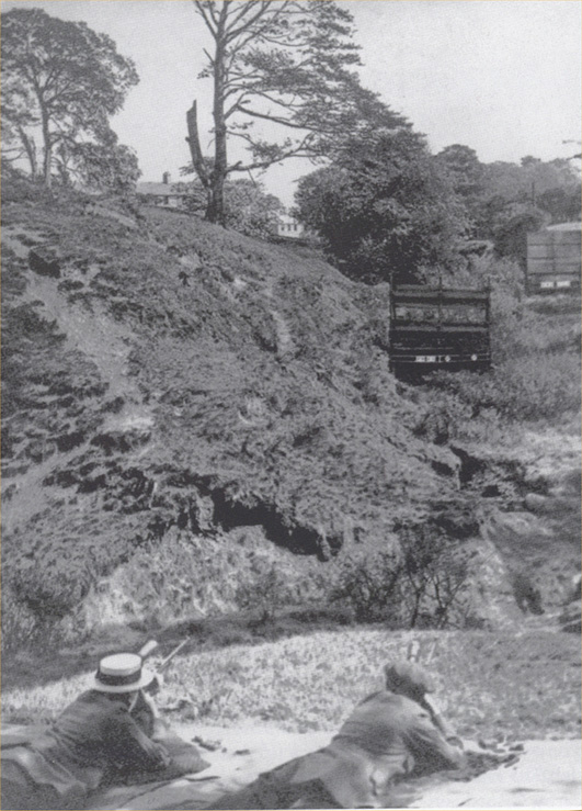
The steep gully, revealed when the pond drained, was then used by Prestwich Rifle Club from 1911, before being quarried, then filled in to make the playing fields we see today.The brooks were both culverted and still provide the water into what remains of Prestwich Clough
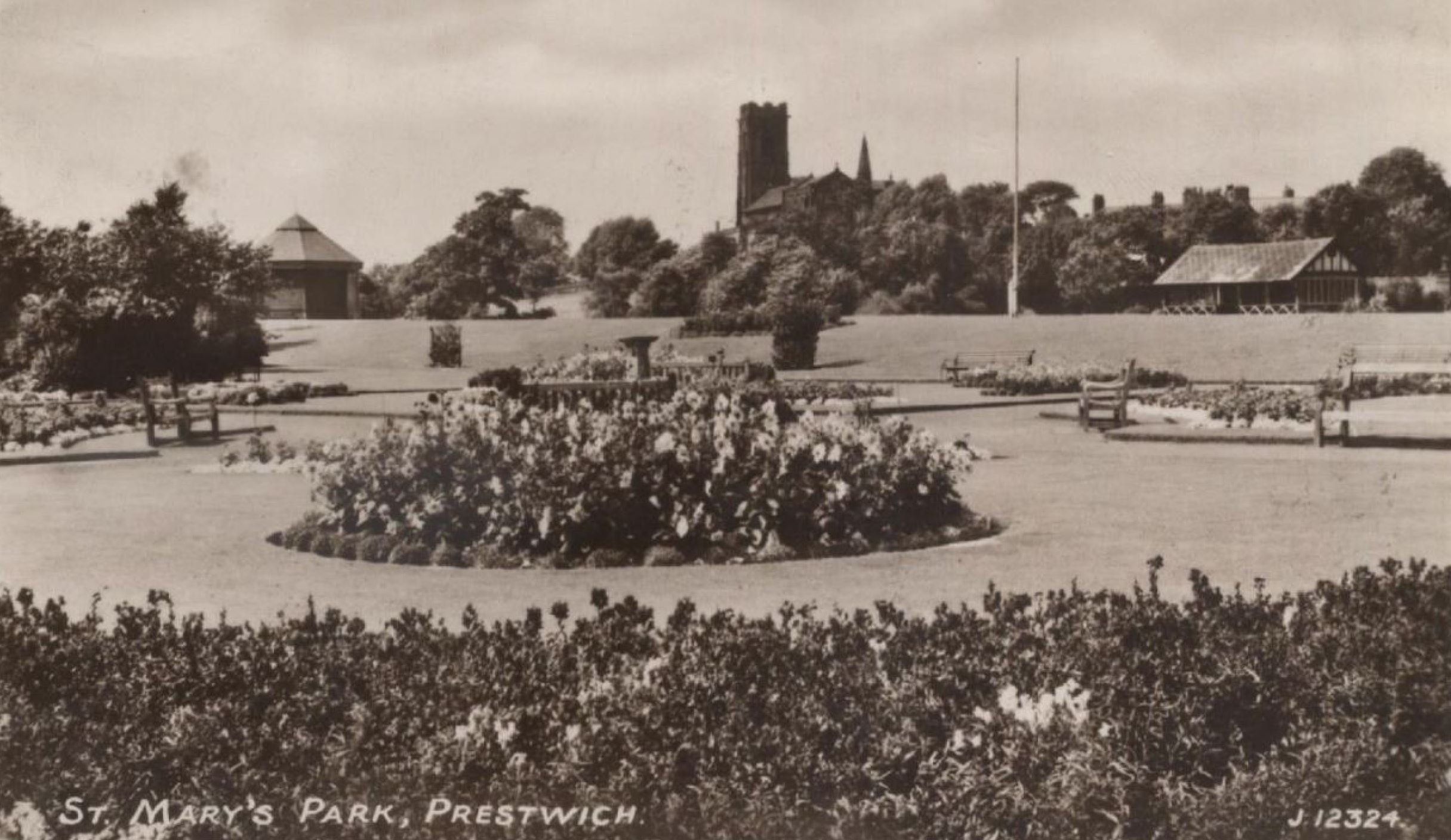
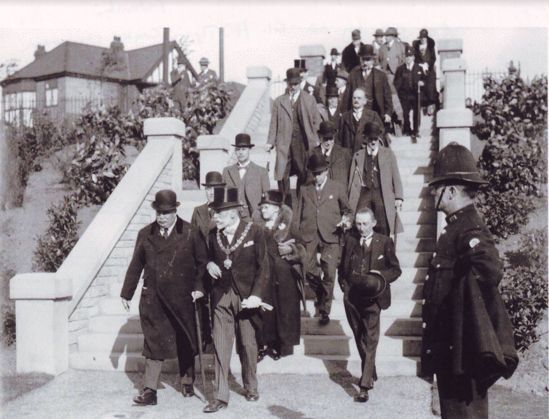
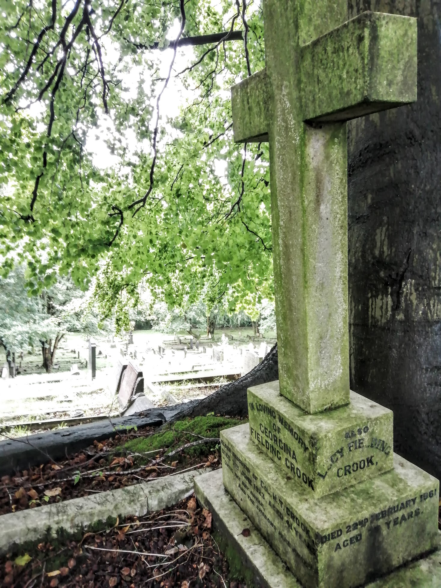
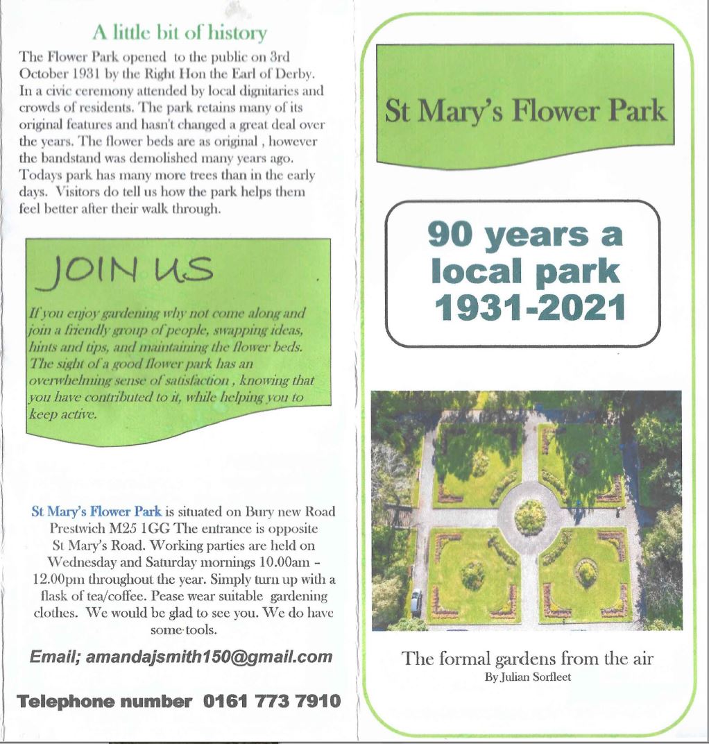
St Mary's Park was opened to the public on 3rd October 1931 by Edward Stanley, the Right Hon the 17th Earl of Derby KG, GCB, GCVO, TD, PC, JP (!), escorted by the then Chairman of Prestwich Urban District Council, Colonel Henry Tipping Crook, in a civic ceremony attended by other local dignitaries and crowds of residents.
Henry Crook was also an honorary Colonel, and had been President of the Peak District Footpath Preservation Society in the 1920s.
I'm sure Henry chose this grave plot, as it would have had a clear view of St Mary's Flower Park. Since then the trees have grown and the view has been lost.
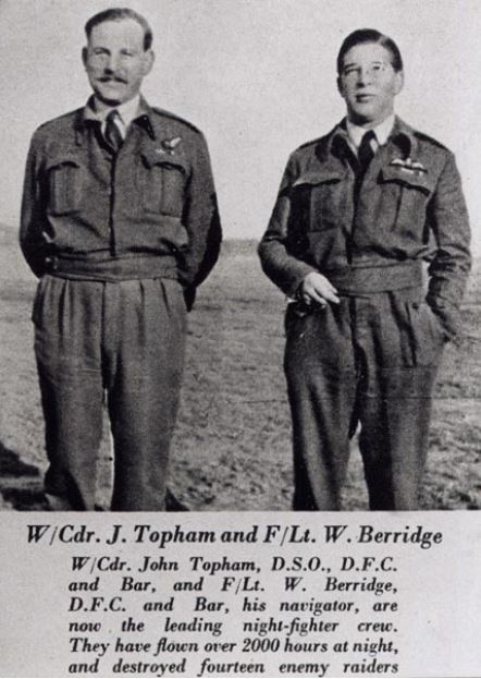
WW2 local hero, Squadron leader Johnny Topham D.F.C. with Bar & D.S.O., who had attended Stand Grammar School, addressed a rally in aid of the war effort in the park. As a nightfighter, he was credited with destroying 12 bombers, plus 1 more probable, and a damaged Me110.
See a map of WWII locations
Remembrance of those that have served the Nation in conflict.
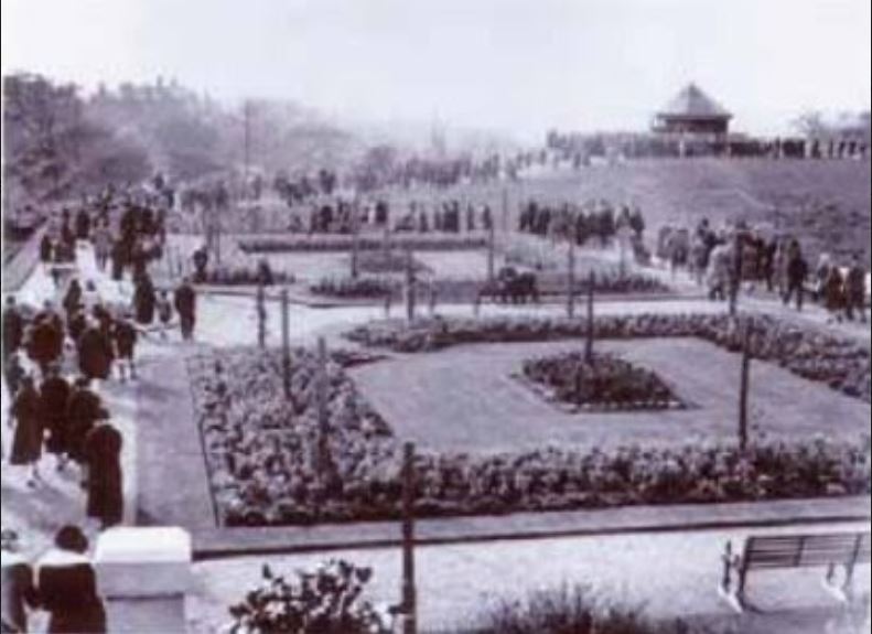
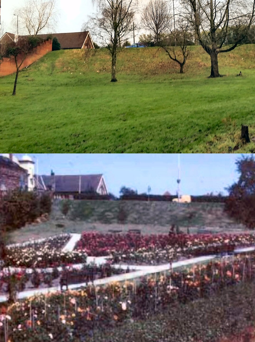
The band stand (which became a bird house until being burnt down in the late 80's), the pavilion, birdbath,toilets and the south path access to the Clough have now all gone (erosion now makes the path impassable).The park retains several of its original features though, and hasn't changed a great deal over the years.
A small extension to the park was added about 1967, and marked the centenary of the Prestwich Local Board in 1973- which later became the U.D.C. It was laid out to the North of the Flower Park, separated by a hedge. Paving has been removed and it has now been left to grow more wild. The cobbled steps down from Bury New Road, continue via a recently replaced duck walk, and mark one of the oldest pathways in Prestwich. This path led from The Deyne Rectory to the southern porch of the Church. The pathway squeezes between St Mary's flower park and the bowling green of the Conservative Club, before being lost under residential gardens along St Mary's Road.
The Flower Garden is currently maintained by a dedicated group of volunteers, and celebrates its 90th anniversary in October 2021.
90th Birthday Leaflet:
Prestwich Clough & Flower Park :
Facebook group discussing the planned improvements
JOIN THE VOLUNTEERS
Prestwich Clough Heritage Trail - on History Pin
Prestwich Clough Heritage Trail PDF to print out & take
Prestwich Clough Allotments
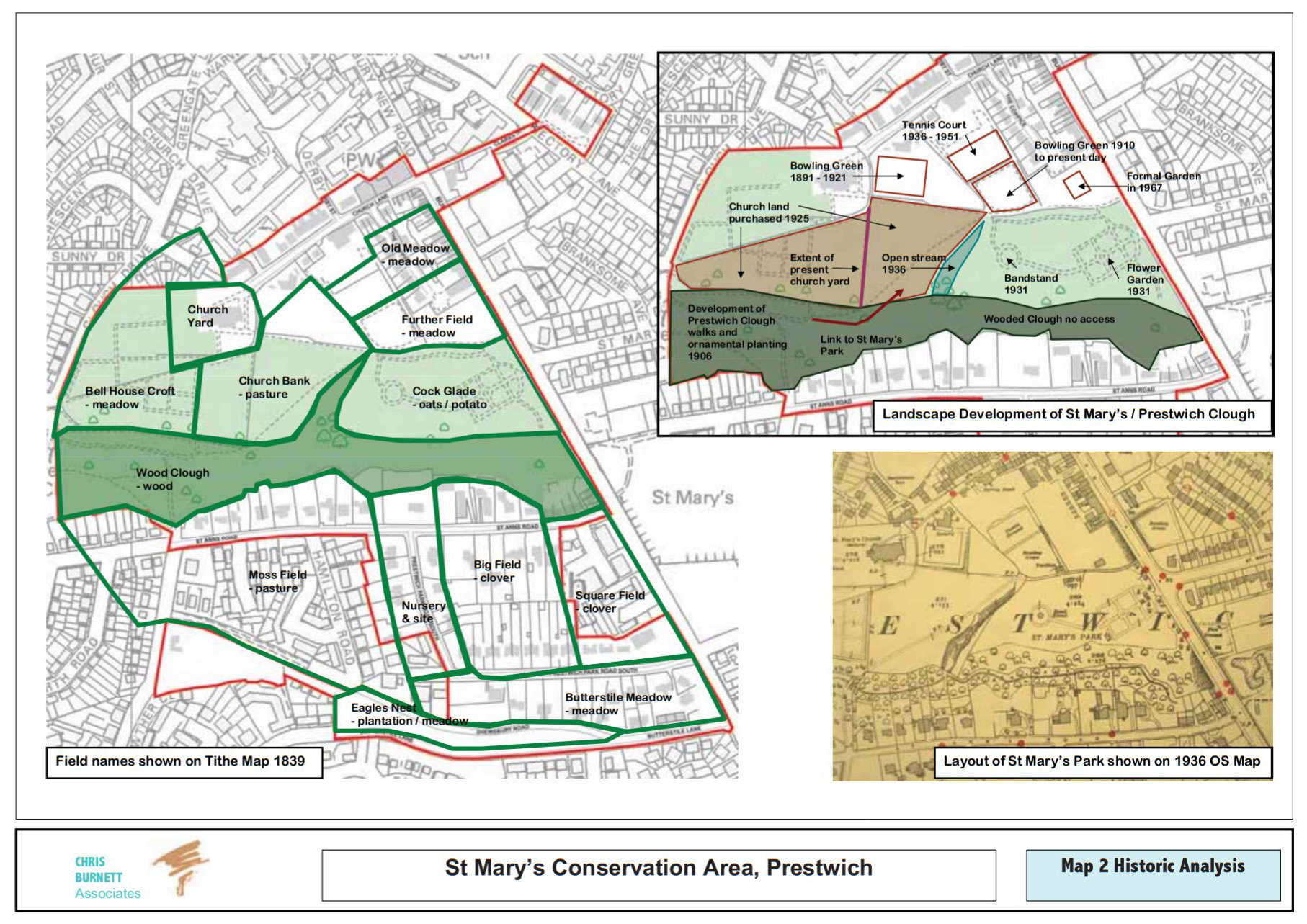
The Land to the West of Bury New Road as you drive up into Prestwich from Sedgley Park, had been glebeland owned by the Parish Church since medieval times, known as Cock Glade in 1839, it was later known as Churchfields. Rev. Canon F.W.Cooper of St Mary's, secured the land from the Church with the intention to supply the local population with some green space for exercise and wellbeing. The 1839 Tithe map records other individual field names.
The larger Halls (Sedgley, Woodhill, Brooklands, and Polefield) had been selling off their land as the city they had made so much from, started to encroach and pollute their homes. The increase in population, the opening of Bury New Road in 1828, and the coming of the railway in 1879 resulted in increased land value, and the owners cashed in.
Small, yet still luxurious estates such and Prestwich Park,Hilton Park and Sedgley Park sprung up in the grounds of the Halls. Then, to meet the post war population boom, the council bought swathes of land and set about building large estates for thousands of people, such as Heaton Park and Gardner Road, and also in Sedgley Park and Polefield. These estates were further expanded in the 1930's.
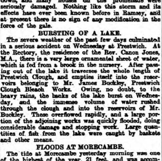
On the opposite side of Bury New Road from the Churchfields, were the Hayfields, the site of the old Rectory ( The Deyne ) and it's pond, fed by the Deyne Brook along with a lesser brook, from what is now Bannerman Avenue.The Rectory pond, called The Dingle, had been created about the 15th century, by damming the top of Prestwich Clough, but this dam failed during the great storm of 1896.
Watch a video of the area developing over time.
See similar videos of the development of Prestwich on this
![]() YouTube Playlist
YouTube Playlist
Edward Stanley had been Chief Press Censor in Cape town during the Boer War, and was an honorary Colonel. He was Lord Lieutenant of Lancashire when he opened the Park, and went on to be president of the National Playing Fields Association in 1937.
In 1937 the Flower Park was used by the community to celebrate the coronation of King George the VI.
Before the decade had ended, Prestwich found itself sending more young men and women off to fight the second World War, as well as working locally in protected occupations, serving as Home Guard (based on Moor Lane), ARP, AFS etc, and as civilians performing fire watch duties as enemy bombers flew overhead destined to bomb the factories in Clifton, the Docks in Salford, and of course the local population itself.
Soldiers on the park steps, then & now.
See similar videos of the development of Prestwich on this
![]() YouTube Playlist
YouTube Playlist
Remembrance in & around Prestwich
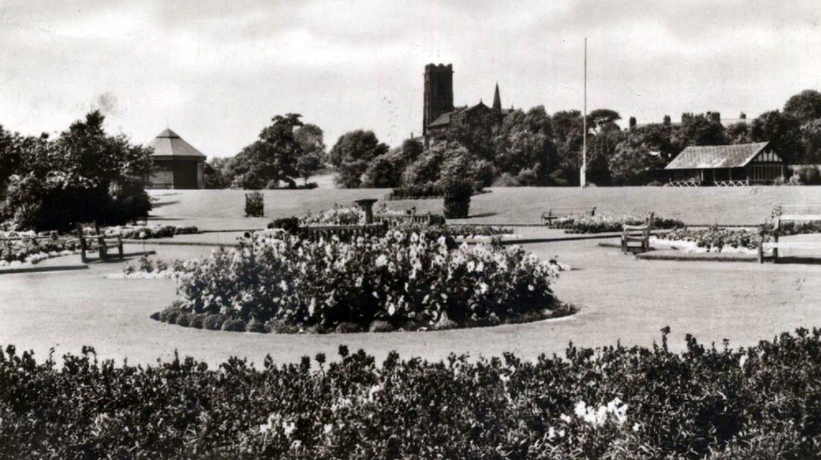
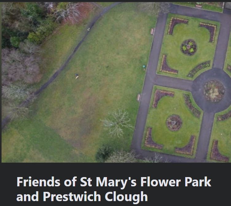
It consists of four grass quarters with a circular bed at it's centre surrounded by tarmac paths (originally red gravel). The central path leading down from the main steps goes on to form a curving ‘avenue’ approach to the
former bandstand site. The beds within the grass quarters have been reshaped over the years.
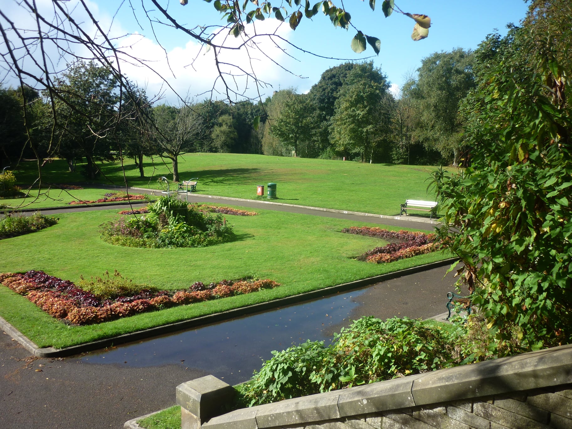
The park on the west side of Bury New Road was originally St Mary's Park, and was renamed St Mary's Flower Garden between 1996 and 2004 (however Google maps knows it as St Mary's Flower Park). St Mary's Playing fields are over the road, and both remain popular places for events, such as the annual Prestwich Clough Day, and the occasional Bands in the Park, Prestwich Carnival, "Festwich", private fun fairs, keep fit groups, local sports clubs, and local families just out to relax. The local heritage trail, St Mary's Conservation area, and Churchyard with it's tranquility and tours, as well as paths towards Drinkwater Park, Waterdale, Philips Park and the Irwell Valley for the more energetic. With routes for walkers as well as cyclists.
Friends of Prestwich Clough & St Mary's Flower Park
Prestwich Clough & Flower Park
If you enjoy gardening why not come along and join a friendly group of people, swapping ideas, hints and tips,and maintaining the flower beds.
St Mary's Flower Park is situated on Bury new Road
Prestwich M25 1 GG The entrance is opposite
St Mary's Road. Working parties are held on
Wednesday and Saturday mornings 10.00am -
12.00pm throughout the year.
Simply turn up with a
flask. of tea/coffee. Please wear suitable gardening
clothes. We do have
some· tools.
Email; amandajsmith150@gmail.com