 Lords
Worship
People
Places
People
Contact
Lords
Worship
People
Places
People
Contact
Clough Lane
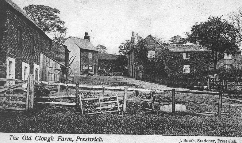
Clough farm has been held by several farmers: Gartside (1754) Leake (1841) Rayner (1851) Knott (1861-1891 known as Knotts farm). In 1901 Joseph Leach lived at the farm, but his occupation was a Farm Bailiff, so must have been there to tidy things up for the land owner, William Gardner. By 1911 there was a new farmer in residence, William Smethurst
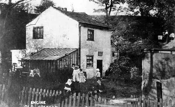
The Old Engine Cottage had once been a yarn bleaching croft, taking a supply of water into lodges from the stream and the fields above. By 1861 there was Willis Knight, Blacksmith, resident. For a few years it then acted as a tea room when the Clough was opened as a park in 1906, before being replaced with a modern Team rooms set between two cottages. One of which was called Ivy Bank. The tea rooms were run by the Grimshaw family. Read more about Prestwich Clough Tea Rooms here.
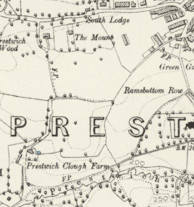
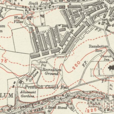
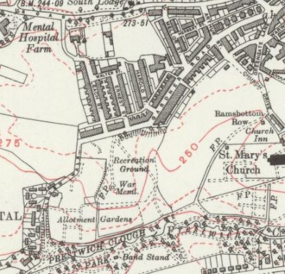
By 1923 allotments had been added above and below Clough Farm, and recreation ground laid out at Gardner Mount.
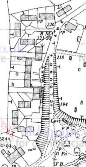
The farm yard opposite Clough Farm was replaced with 25 houses called Clough Walk by the 1930's.
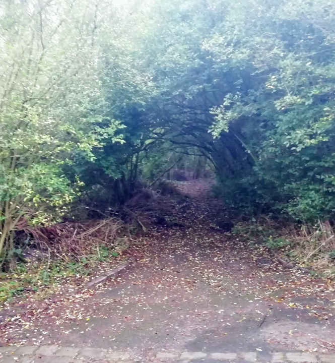
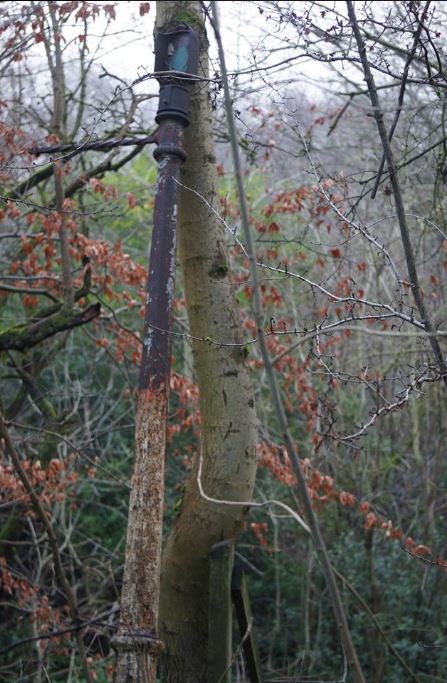
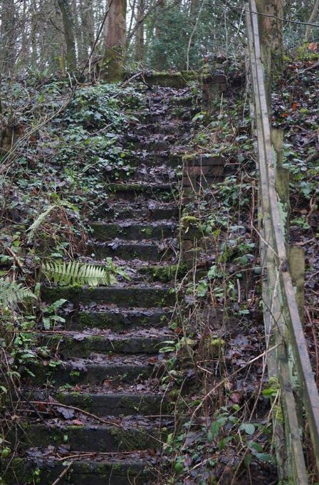
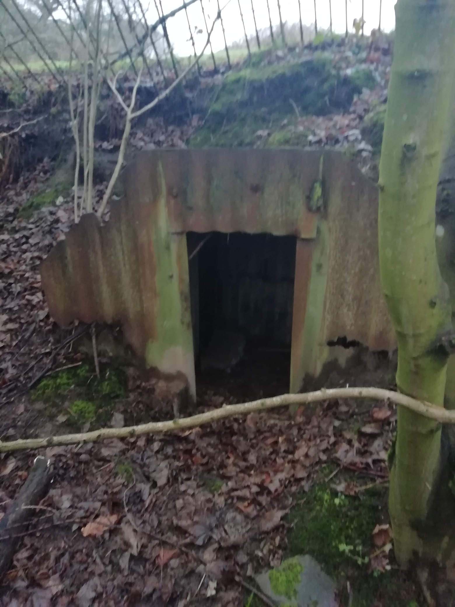
The houses were pulled down but some signs remain in the undergrowth with the cul-de-sac now forming a tunnel of trees, an Anderson shelter belonging to Number 1, and a lamppost at the top of the steps down into the Clough.
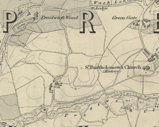
The map of 1845 (above) shows how Clough Lane ran down from Prestwich Wood on Wash Lane (Clifton Rd today), over the top of the field and down past Clough Farm.
Watch a video of the area developing over time.
The lane then crossed the stream at the Old Engine Cottage and turned right onward to Buckley's Bleachworks.
By 1891 Clough Lane had started to branch out above Clough Farm towards Greengate, along what we would now call Gardner Rd, named after the land owner.
The Clough had been opened as a public park in 1906, after the Council purchased the land from William Gardner, and by 1910 housing had been constructed and the connection had been made to Greengate, with the path down from Wash Lane now represented by the back boundaries of the properties on the West of Leach Street, and the main route was via Gardner Road. The land to the south of Gardner Road was knows as Spion Kop, named after a Boer War battle of 1900, in which the Royal Lancashire Regiment had fought to defend a steep sided hill of that name. The battle had been subjected to major blunders by the British commanders. Twenty thousand soldiers were misled up a hill, only to find themselves not on the high ground after all. Spion Kop translates as spy hill, or hill with a good view. The battle ended in defeat for the British as they were overlooked by the Boer snipers and artillery. Some 330 died and 1000 wounded. In memory of their fallen pals, returning soldiers named places Spion Kop, such as the football stands at Anfield, Hillsborough and Elland Road. Local soldiers must have drawn comparison to the steep hill rising up from the Clough, and the name stuck for some years until it was renamed Gardner Mount.
Watch this video exploration of Clough Walks, including the Anderson shelter and Clough Farm House.
Part 2...lower section of Clough Walks, including an old lamppost and the steps