 Lords
Saints
People
Places
People
Contact
Lords
Saints
People
Places
People
Contact
The Landslide, Kersal Dale
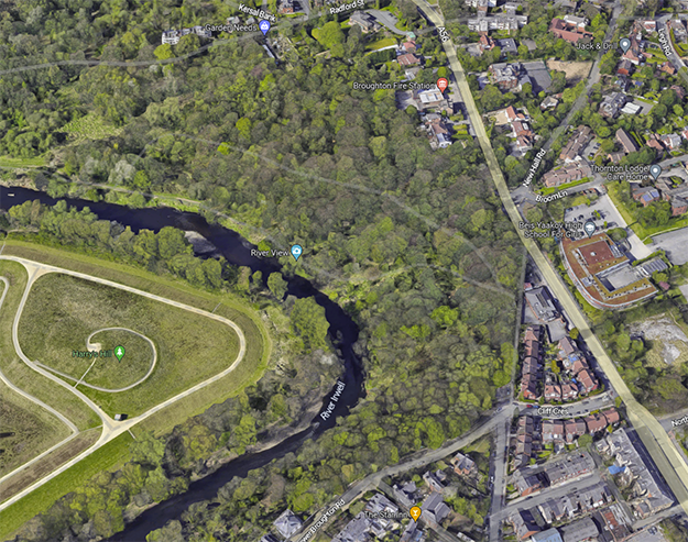
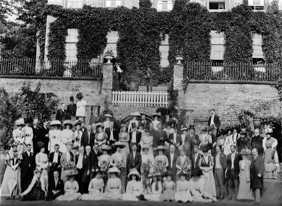
The Lanny stands above a bend in the River Irwell, the view once overlooked the site of Manchester Racecourse, and now overlooks Kersal Wetlands, part of the flood defences of Salford and North Manchester. The Lanny is part of Kersal Dale nature reserve.
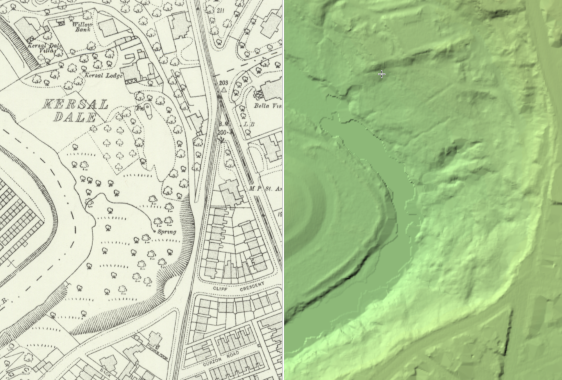
As the Irwell bends, it cuts into the ridge of land between Lower Kersal and Higher Broughton, which has offered passers by a safe roadway since Roman times when the road heading out of the north gate of the fort at Mamucium (Castlefield, Manchester), took the high land to the East of the Irwell Valley on it's way to Bremetenacum (Ribchester).
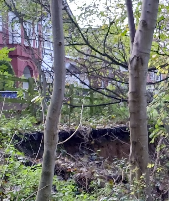
However, the river has undercut the steep slope in the sand and gravel, resulting in an unstable area of erosion and land slips slowly approaching the route of what was the Roman Road. Back during the Roman occupation of England it is expected that the river was further to the West than it is now, having slowly eroded it's way eastwards over the centuries.
Although the Romans left Britain around 410A.D. the route of the road must have still been used in the 12/13th century when someone felt the need to hide a stash of over 1,000 coins beside the road in Prestwich. (see the Prestwich Hoard)
A lane linked Bury Old road to Kersal Moor for people to use their carriages to visit the annual Horse Races. The first reference to the Manchester Races "On Carsall Moore" was in 1687. Of course many race goers did not posses a carriage and chose to walk the shortcut along the old Roman Road, and one such walker described the route from Strangeways over the long neglected Roman Road to Kersal Moor in the 19th century:
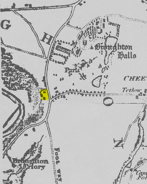
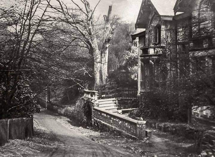
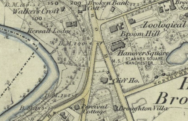
Housing names such as "Roman Road Terrace" near Broughton Grove showed that the road had not been forgotten entirely though, and the property called "Broken Bank" on the map of 1848 shows the people knew the precarious nature of the location. Broken Bank Cottage was later renamed The Hollies, see below and Broken Bank was then used further downstream where the Irwell Meets what is now the Crescent in Salford.
It's worth mentioning that back in Roman times it would not have been called Broom Hill as "broom" is an Anglo-Saxon word (meaning a ‘thorny shrub’), and "hill" dates from Old English, which is also post-Roman (450-1150 A.D).
Abraham Driver, the Deputy Constable of Broughton, wrote in 1834: 'Forenoon went along the banks of the river seeing some bills stuck properly up, to prevent bathing in sight of the roads, or in view of the Gentlemen's houses'. However, this practice continued as L.H. Hayes wrote in the 1840s that the favourite swimming spot, was opposite Castle Irwell, where there was a 'stretch of clean nice yellow sand'.
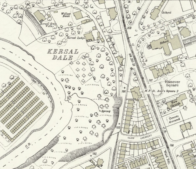
On the actual Lanny it appears only Kersal House (with its lodge) is named in 1841, by 1851 Kersal Lodge also appears with its lodge appearing in the census of 1861. Hoever in the map of 1848 Broken Bank Cottage (later renamed The Hollies, see below) is shown, so the local landslip feature seems to have been well known.
Kersal House was the family home of J H Somerset in the census of 1901 & 1911, he was an architect and the nephew of the artist Richard Gay Somerset. His designs range from Cornerlot, Hardelot, France for Duke of Argyll, to Brighton B Power Station, Shoreham. He moved to London in 1912.
At Cliff House (1841 & 1851), at the junction of Bury New Rd and Great Clowes Street, lived Rev. Oswald Sergeant and his family. Oswald was Canon of Manchester Cathedral(1832–1854). The son of William Sergeant an attorney at law, he had married Elizabeth Milne, the daughter of Rev. Nathaniel Milne of Prestwich Wood. Oswald Sergeant died in 1854.
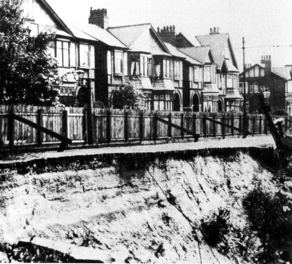
In 1882 there was a large landslip along Great Clowes Street at its junction with Bury New Road. Further slips took place in 1887 & 1888. No houses are shown to have been lost in the maps of this period.
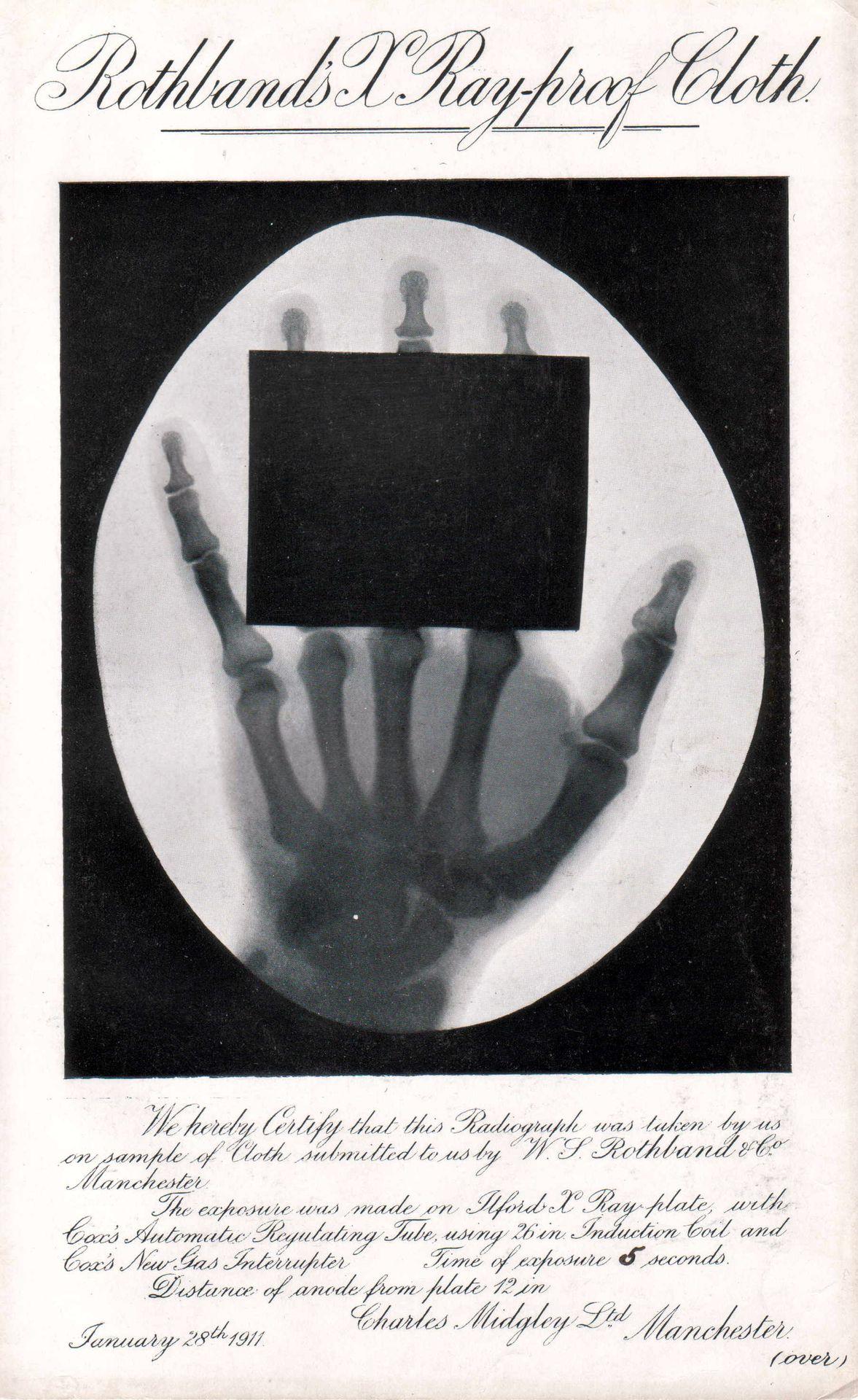
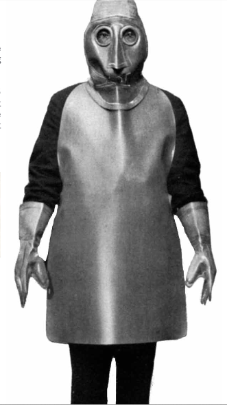
As X-ray became recognised as a routine method of diagnosis, Colonel WS Rothband’s cousin (a chemist) approached him with an idea to add lead powder to the rubber mix. The result, was the production of an X-ray cloth, from this they began manufacturing X-ray aprons and are still going strong today.[Rothband.com]
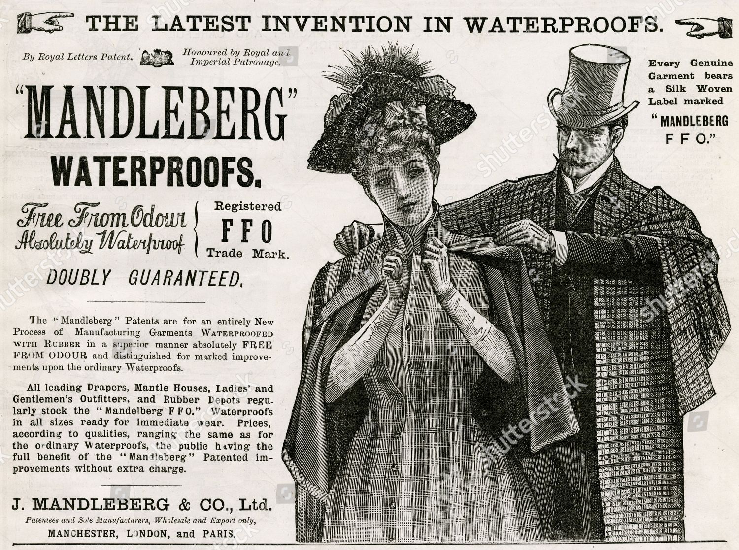
Henry Rothband himself was partnering with Col. Samuel L Mandleberg, in fact in 1878 he went as far as to marry the sister of Samuel, Ella Mandleberg, in Prestwich, and he was appointed as managing director of J Madleberg & Co Ltd, waterproof Manufacturers of of Albion Works, Pendleton. Another Rothband brother, Louis (born in Manchester 1858), lived not far away at 19 Northumberland Street, just off Bury New Rd when he died in 1932. [ In 1934 the Black Shirts of the British Union of Fascists set up their HQ next door to where Louis had lived]
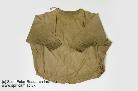
In 1882, Rothband and Mandleberg had jointly advertised rainproof capes, and Henry's business went on to focus on waterproof garments, making items from gas-proof and waterproof fabrics such as waders, coats, trousers, and orders were secured to supply the armed forces.
In 1910 Mandleberg supplied the "Terra Nova" Antarctic Expedition led by Captain Robert Falcon Scott, "Scott of the Antarctic".
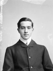
Henry's son Percy served in the Queens South Lans Regt. during WWI, for which he received the 1914-15 Star, British Medal & Victory Medals (Pip, Squeek and Wilfred).
After the Great War, Henry authored "The Rothband employment scheme for sailors and soldiers disabled in the war" which was published in 1917. This was adopted as the 'King's National Roll Scheme' in September 1919.
Under the scheme 5% of any business was to be reserved for employment of those who had been disabled during the war. By 1920, 17,000 establishments were employing 155,000 under the scheme. In recognition of his efforts he was granted the baronetcy of Higher Broughton in 1923. He fell ill while on holiday in southern France, and when war broke out he was unable to return, he died there in 1940.
The following notice regarding the estate of Louis Rothband, another brother of Henry & William (see above), confirms that Sir Henry Rothband was still resident at the Hollies in 1932.
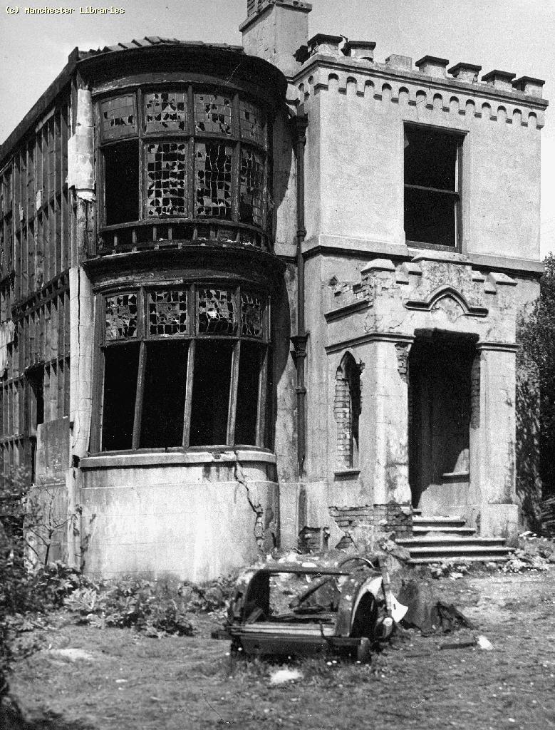
In 1946 Kersal House was advertised as a Residential Hotel and in 1972 it was purchased by Salford Corporation as a residential hostel for the mentally ill. The house was subsequently destroyed by fire and demolished.
As of the map of 1938 the houses were all still standing, and no major slips have occurred since, however the land is still moving...
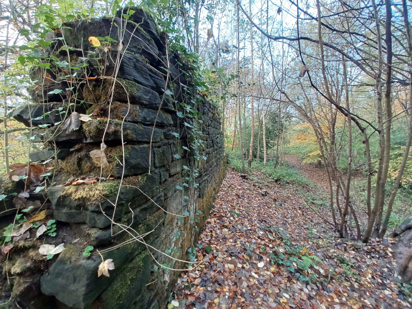
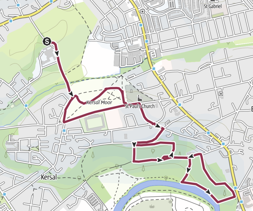
A walk today setting off from Hilton Lane, taking you over Prestwich Golf Course and Kersal Moor will deliver you to the hidden oasis of the Lanny within the hour. You can explore the woodland and the remaining brick walls of the houses and gardens hidden in the undergrowth. [suggested route]
The Manchester Geological Association describes the area as being composed of glacial sand and gravel on top of boulder clay, part of a ridge of glaciofluvial outwash sands extending from Swinton through to Pendlebury and across the Irwell valley to Prestwich and Cheetham Hill. Glacial materials were pushed by glaciers down from the north during the last Ice Age which ended ten thousand years ago.
Over the following centuries the Roman road was just about forgotten by most people, with the main route North out of Manchester taking the Cheetham Hill/Bury Old Road route, which had less streams and cloughs to cross and would have presented a less easy target for any highway men lurking to help themselves to your possessions.
'An extensive meadow almost reaching from Cheetwood Lane as far as the present (1890) Waterloo Road was covered with rich grass, the hawthorn's rich scent perfuming the air. The road is in a tolerable condition as far as the corner of Broughton Lane. After this we are soon in Stony Knolls, a mere good road, a beaten track over hill and valley until we reach Cliff Point, the junction of Lower Broughton Road with the road to Cheetham Hill and Prestwich. Here we enter a sandy lane and in the side nearest the river are a few old houses, one of them a public house nicknamed "Hard Backed Nan's". In the valley nestles a comfortable farmstead. We pursue our way through this sandy lane and on a narrow road without even a footpath.'
[Taken from Broughton & Cheetham Hill (in the Regency and Victorian Times) - by the late Monty Dobkin]
The name Broom Hill also appears on the 1848 map, and Broom Hill Lane (later shortened to Broom Lane) also hints, not only at the local plant life - yellow broom bushes thrive on sandy and gravelly soils of glacial drifts, but also at the location being a high point. This hill would would have been used by the Romans as they laid out their road based on line of sight. From Broom Hill it is quite possible that the Romans would have had a view of Affetside, above Tottington, and between these locations the Roman road took a straight line.
The name Stony Knoll, used in the above description, also hints at a hill top derived from Old Norse "knollr" - again a post Roman name.
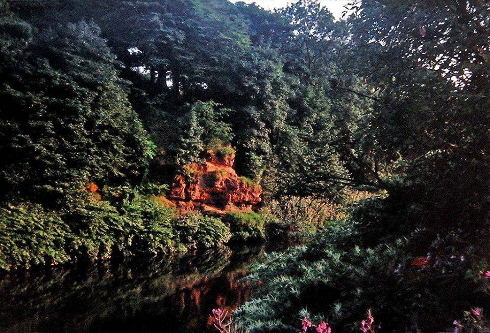
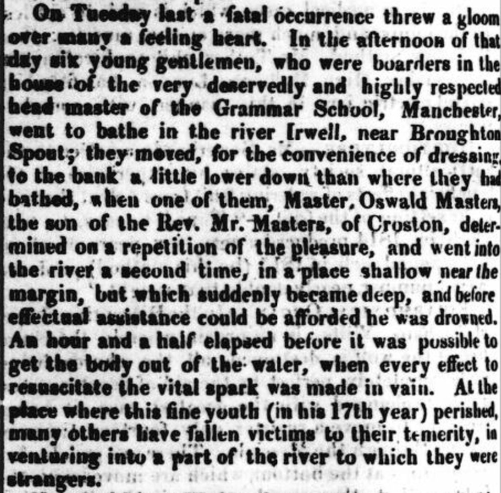
Along the course of the river Irwell there are numerous locations where the underlying sandstone was exposed, and they gained the name of Red Rock, such as near Giants Seat or at Bradley Ford. Another such location is just down stream from the Lanny. The area back in the early 19th century was scenic and popular with bathers. Sadly one unfortunate lad, Oswald Masters, son of Rev. Masters, went bathing along with five fellow lodgers from the house of the Manchester Grammar School's headmaster,Jeremiah Smith. Oswald returned to the water as the other were getting dressed and he got into trouble and drowned.
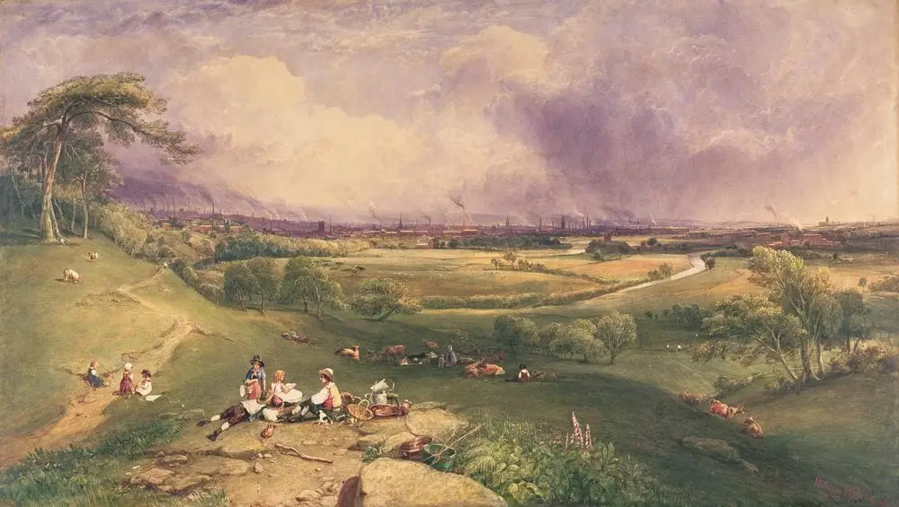
As the 19th century progressed, Manchester expanded and the wealthy merchants and professionals started building their large houses in the countryside around Manchester and Salford. The census returns from 1841 onwards show a mixture of solicitors and linen merchants living around Broom Hill, along with gardeners living in their lodges & cottages to maintain the owner's pretty surroundings. In 1851 Sycamore Cottage was home to a stuff merchant, one who trades in the finers materials and wools of the fabric industry (the gowns of English lawyers are called "stuff gowns").
Kersal House was put up for sale in March 1883.
"this family residence situated overlooking the valley of the Irwell; the site of the property is 28,639 square yards (almost 6 acres) which is subject to a moderate ground rent; the situation is secluded and private, and there is some fully grown timber on the property. The pleasure grounds are nicely disposed and planted." [Manchester Guardian, March 1883]
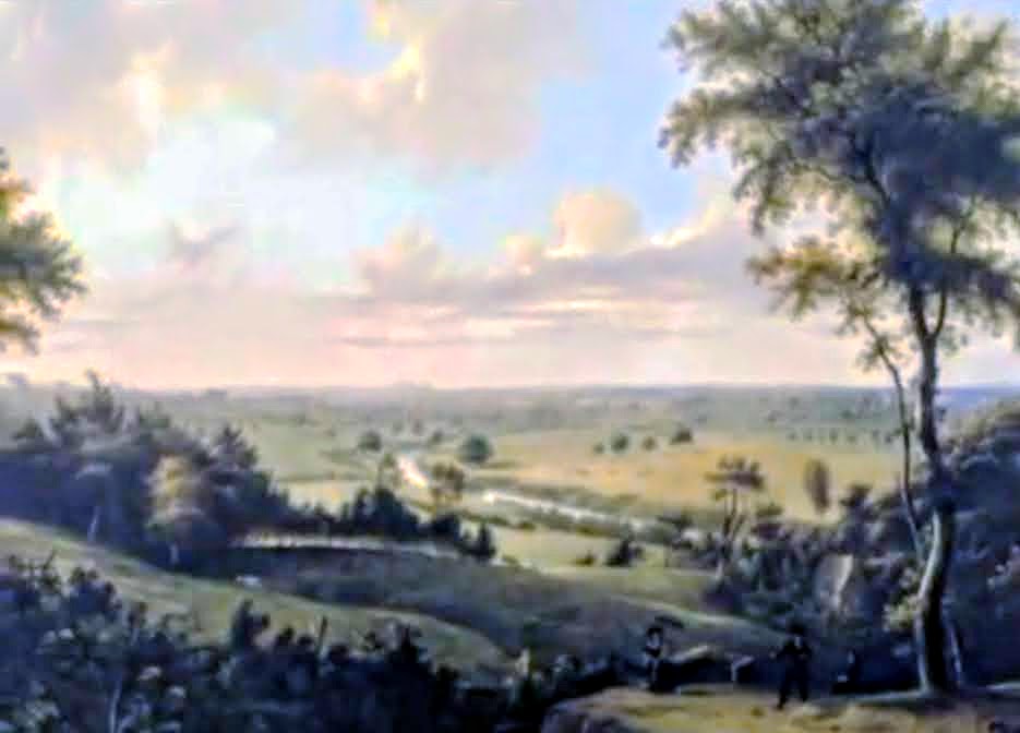
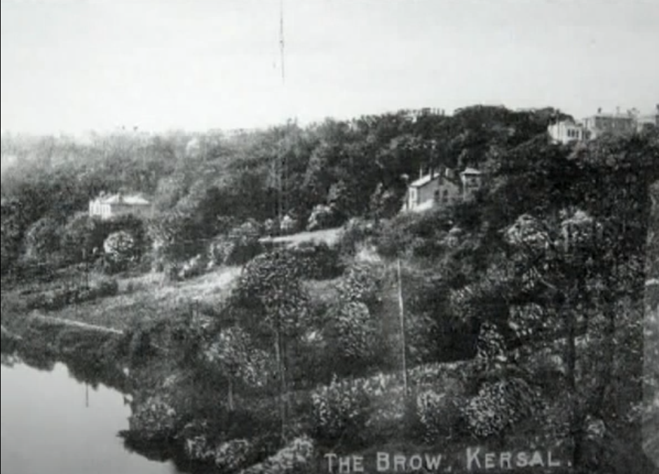
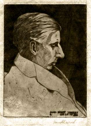
"Here we enter the still beautiful bend of the river below The Cliff, Kersal Dale and Kersal House. Many extensive and flourishing gardens still remain on the hillside around this bend, though the smoke of the town has destroyed some of their former luxuriance. There are still many fine trees, and owing to its quietness many species of wild birds still frequent the place, and there are also flying visits from the more migratory species. [J. Corbett, The River Irwell, 1907]
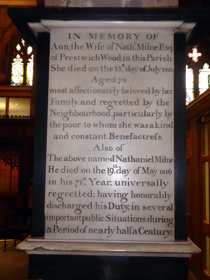
The Milne FamilyThe Milne family into which Oswald had married, was a longstanding landowning and influential family in Prestwich. Nathaniel (b:1746) and his wife Ann (b:1743) lived at Bent House in Prestwich and later at Prestwich Wood.
Nathaniel was churchwarden of St Mary's in 1805 and an early benefactor of the first Sunday School in Prestwich. Nathaniel and his wife are buried at St Mary's Church in Prestwich.
As well as their son Rev Nathaniel (b:1811) who became the Rector of Radcliffe (1839-1846), their son Oswald (b:1826) became a solicitor, and clerk to the magistrates at the New Bailey, Salford. Another son Edward became an attorney and clerk. In 1847, Oswald Milne, sold some of 62 acres his father had bought at Prestwich Wood, for the construction of Prestwich Asylum which opened in 1851. Their daughter, Nanny Milne married John Sharp F.R.S. and F.S.A. of Alkrington Hall and solicitors Sharpe, Eccles & Cririe of King Street, clerks to the Mersey & Irwell navigation, the forerunner to the Manchester Ship Canal.
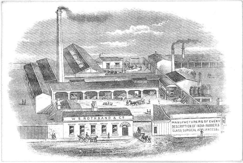
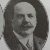
By 1901 a notable resident moved in to The Hollies (known as Broken Bank Cottage on the map of 1848). Henry Lesser Rothband had been born in Cracow (1853), Austria in 1850 and was an India Rubber Manufacturer. Joseph Rothband a tassel manufacturer had come to Cheetham Hill about 1840. Henry's elder brother WS Rothband (also born in Cracow, 1850) had established his company named after himself, manufacturing waterproof items, such as cloths, bags, mattresses and bed covers. These were predominantly supplied to the Asylums and boarding houses of the region. The company went on to provide other rubber equipment such as cathetas, tubes, gloves and aprons.
The same census of 1901 shows a second Waterproof Manufacturer, Samuel Wiener also from Cracow, was living next door to Henry at Kersal Cottage. Though Mackintosh famously established the Manchester Rubber and rainwear industry, legend has it that the smell of a rubber mac could stop a clock. It was Mandleberg who pioneered the FFO (free from odour) rainwear.
However none of this is why Henry, or shall we say Sir Henry Lesser Rothband rose to fame. He may have been Lesser by name but not by nature !
Henry Rothband was a member of Manchester Reform Club, and the Jewish Naturalisation Society, through which he encouraged working class male immigrants to save a shilling a week towards the cost of British naturalisation papers.
He took an active part in recruiting the Salford battalions during the war. He chairman of Harben’s (Viscose Silk Manufacturers) Ltd and was a founder of the British Manufacturers’ Corporation, later merged in the Federation of British Industries, of which he became a vice-president.
Sadly Percy took his own life on a train arriving in to Manchester in 1926 leaving a letter to Sir Henry stating...
"I can't stand not sleeping anymore. Something inside me has gone smash, and I cannot stand it any longer."
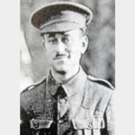
WS RothbandWS Rothband's daughter Esther married an American, Dr Cohen, became a senior anaesthetist to St Mary’s Hospital for Women and Children, and the Educational Committee School Clinics in Manchester as well as the first editor of the British Journal of Anaesthesia. William also lost a son, Jacob Eustace Rothband, serving with the Manchester Bantams at the Somme on the 20th July, 1916. Jacob had walked along the parapet just prior to his Company attacking. Trying to rally his men he shouted, ‘Come on boys, don’t be afraid of their guns’. He was shot through the head almost immediately. Jack Rothband was from Cheetham Hill, but was in San Francisco in 1914, and returned to Britain to sign up for service. An old boy of Manchester Grammar School, he had been an officer with the Jewish Lad’s Brigade in Manchester.
On the 15th July 1927, after a torrential downpour the worst landslip at Higher Broughton happened, causing part of Great Clowes Street, which meets with Lower Broughton Road, to fall away, taking with it part of the main road, cobbles tumbled and tram lines eneded in mid air. In expectation of the slip the trams had been diverted along Knoll Street in 1925.
The directory of 1927 shows the houses on the Lanny were still occupied, a schoolmaster was living at Sycamore Cottage, a mantle maker at Kersal Lodge, a manufacturer's agent at Willow Bank and a sharebroker lived at Kersal Dale Villa.
The following year, none of these properties were listed in the directory.
In 1933 the Salford Corporation introduced a "prescribed area" bounded by Bury New Rd, Great Clowes Street and Cliff Crescent. Inside this area the houses could be vacated, and people stopped from using them. In 1966, erosion of water drainage was also a concern, Cliff Crescent was closed and Knoll Street collapsed along with parts of Hope Street.