 Lords
Saints
Places
People
Contact
Lords
Saints
Places
People
Contact
Waterdale
With thanks to Peter Corbally of P&WHS
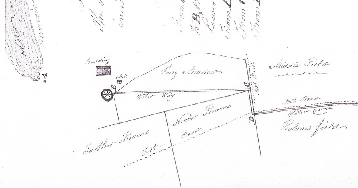
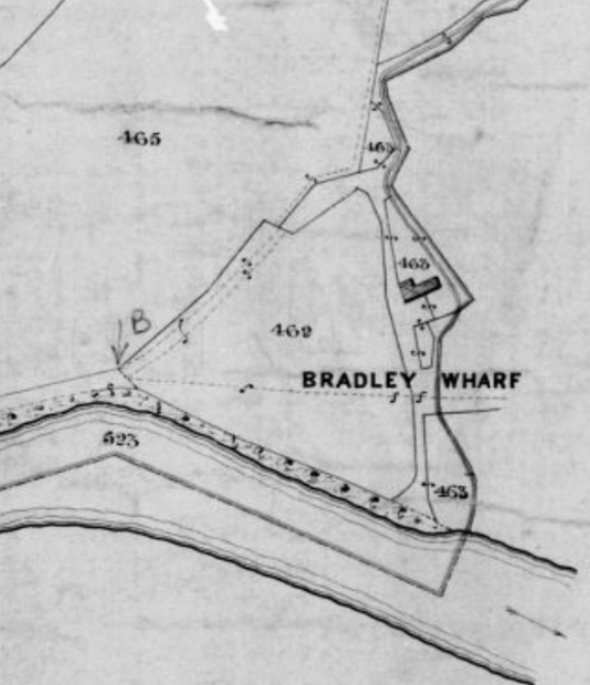
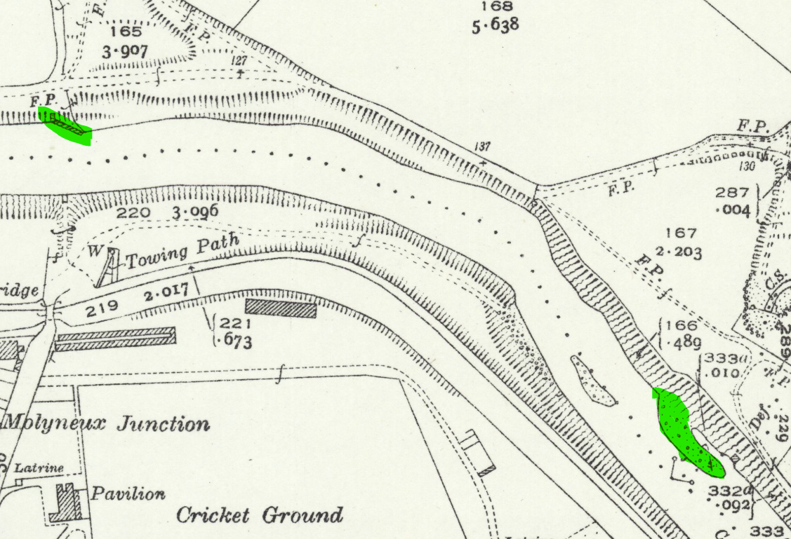
The above map shows the naming of the fields.The water channel ran off towards "Old Fleams", Fleams Farm, and in to the reservoir in Drinkwater Park.
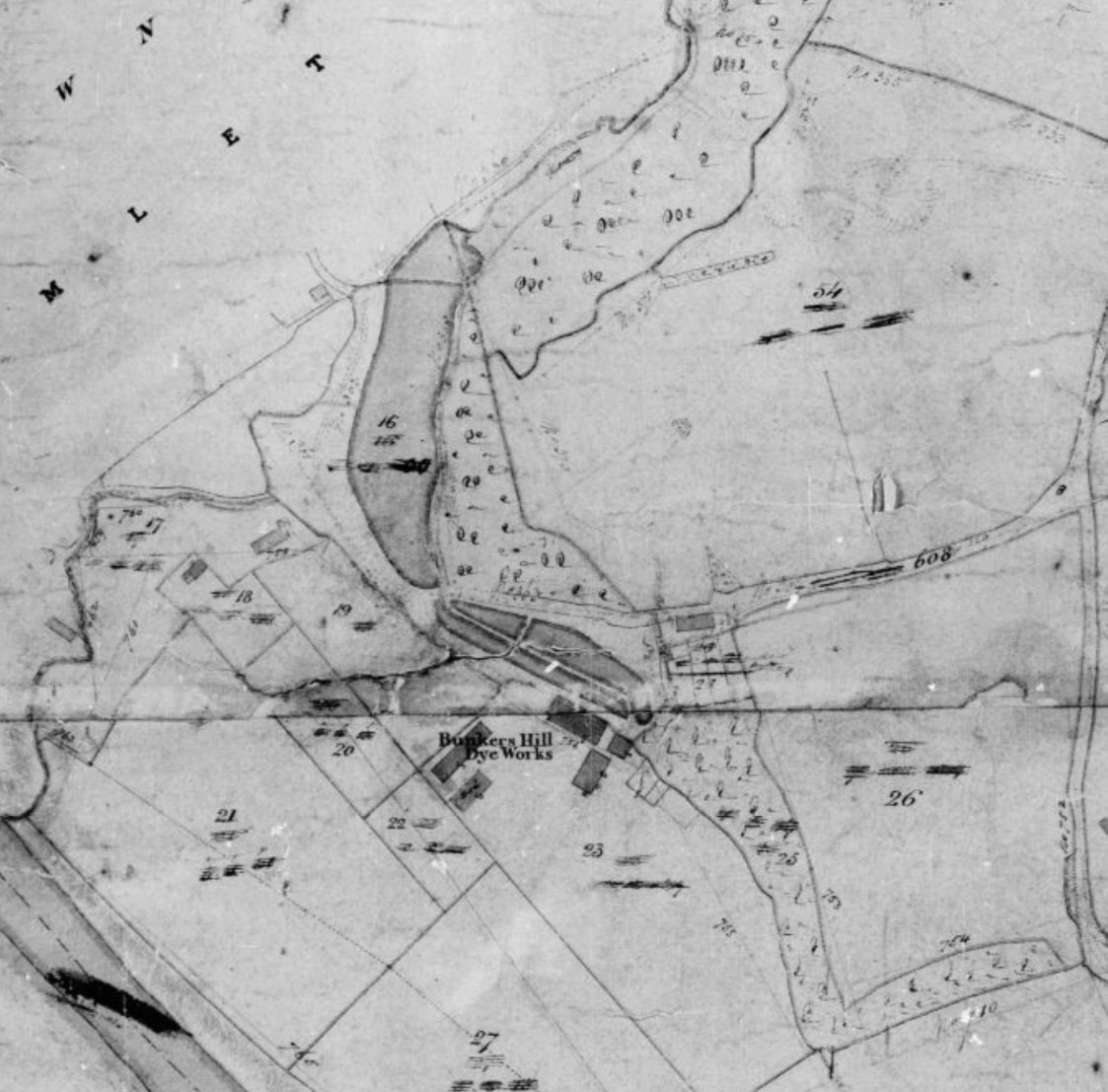
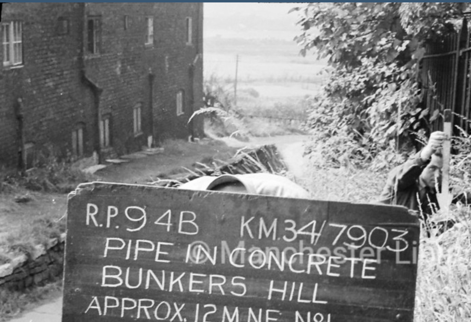
Issachar had Dams Head Lodge built by hand sometime between 1783-1813 to supply his bleach works and dashwheels with water. It features a 50-foot deep overflow drain. Thorpe’s premises were known as Bunkers Hill Dye Works.
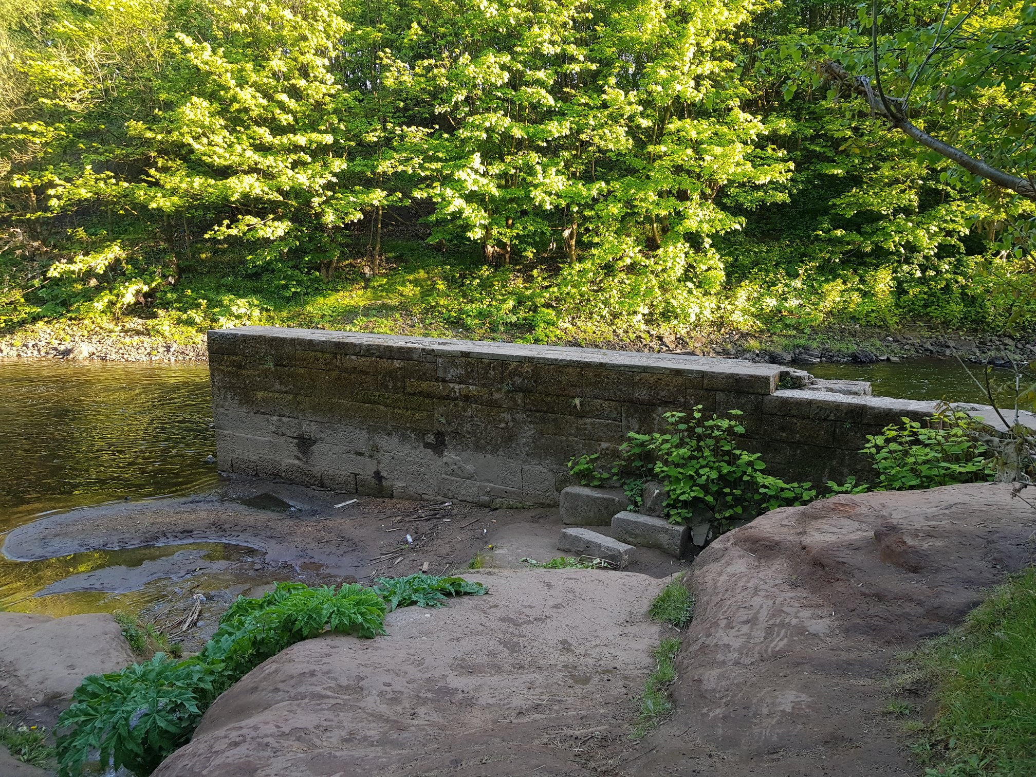
Next to the railway viaduct, on the edge of Waterdale is Clifton Aqueduct, built in 1796 to
carry the Manchester Bolton and Bury Canal across the Irwell. Surprisingly, despite the industrialisation, the walk along the river from Bradley Brook to the Clifton Aqueduct was a popular Sunday 'promenade' in the Victorian and Edwardian eras. There was even a tea
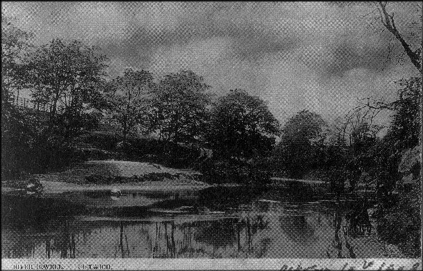
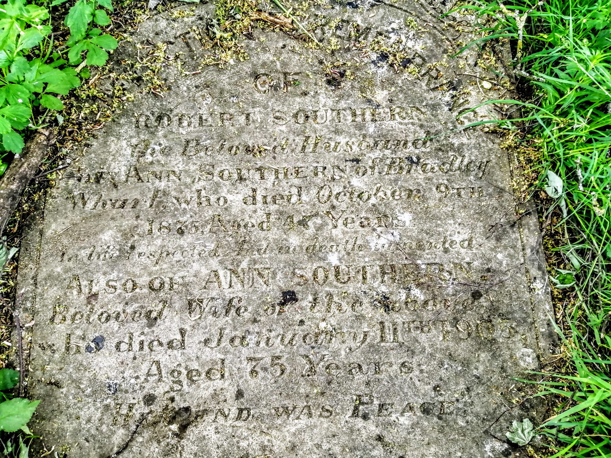
room near Red Rocks called Mrs Southern's Cottage (aka Bradley Wharf).
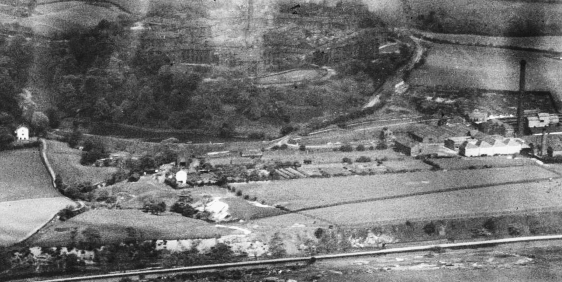
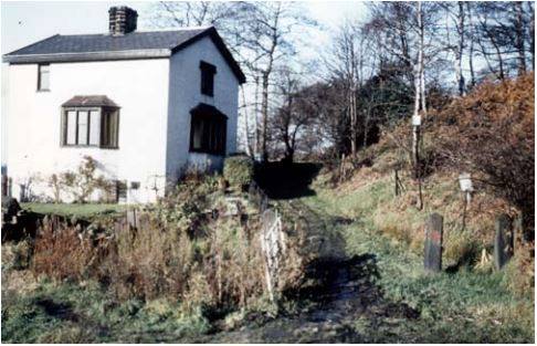
The above photo shows South Lodge on the left, Bradley Farm Centre, with Dams head Lodge above it, and the works with Bunker Hill Cottages above, on the right. The Hospital Annex stands above.
M62 Motorway construction spoil and subsequent landscaping of the demolished factory sites have buried or removed many earlier features. Now only the mill lodges remain. Spoil excavated from the motorway construction was deposited on Cobster Field (Philips Park) and Waterdale.
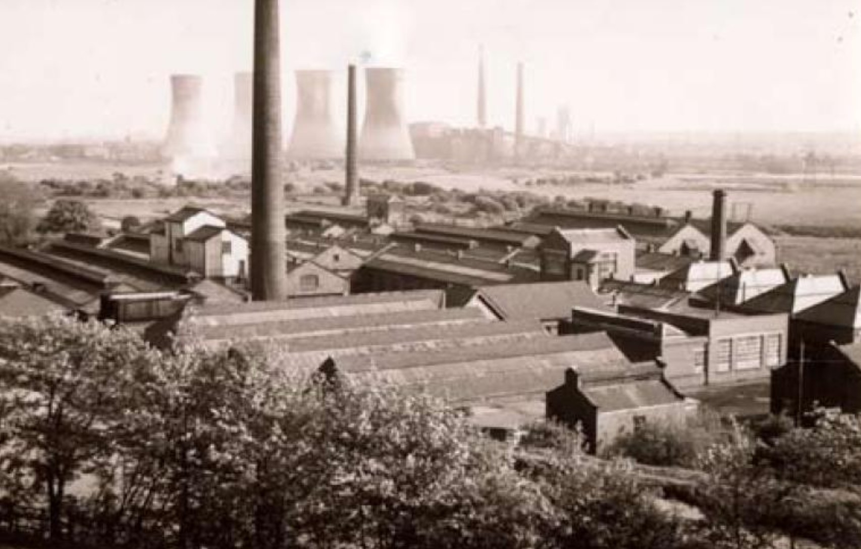
In front of the cooling towers of Agecroft Power Stations you can see the chimney of the incinerator which was part of the Prestwich Sewage Works.
In 1996, as part of the Waterdale derelict land reclamation scheme adjacent to the park, the remains of South Lodge were excavated and consolidated.
The area of Waterdale probably gained it's name for good reason, with two streams feeding into the Irwell, from North Wood & Mere Clough, the latter was renowned amongst botanists in the Victorian period for the variety and profusion of its flora. Read more about the Artisan Naturalists.
It is likely that Waterdale was farmland up until the end
of the 18th Century. The land formed part of the Fleams Estate (owned by Thomas Drinkwater), a fleam being a man made water course. Read more about Drinkwater & the Tudor Mill.
With the advent of the Industrial Revolution, a whitster set up his works,harnessing the power and plentinfulness of the water. Later lodges were built on both of the tributaries to feed a steady supply of water to the works.
Molyneux Mill (later known as Outwood Bleach works), stood on the stream
flowing from North Wood, and was present by 1837.
A whitster called Issachar Thorpe had been the first local person to step up to bleaching on an industrial scale in his bleach works at the bottom of Mere Clough in Prestwich, about 1772.
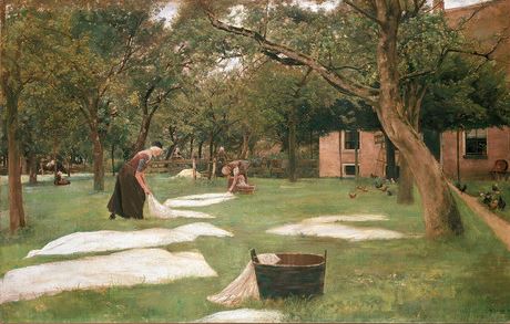
A whitster, or whitner, removed the impurities such as seeds shell and waxes from cloth by dipping and stirring the cloth in large containers of alkali, a mix of potash and lime (bowking). Once bleached, the cloth could then be dyed, but first would be laid out, or hung up on tenter frames (secured with tenter hooks) to dry in communal or private bleaching crofts. This practice lead to names that live on today, such as Whittaker.As chemical replacements for natural substances (such as urine) were discovered the Whitsters became Bleachers, and machinery was introduce to the industry.
Bunkers Hill was probably named after the local sandy geology, leading to sandy bunkers, similar to "the bunks" (recently renamed, Pringle Walk). Perhaps though it was named by a soldier returning from America after the Battle of Bunker Hill, fought in 1775 for control of Boston Harbour during the American Revolution, perhaps similar to how "Spion Kop" got it's name from a battle of the Boer War, but is now known as Gardner Mount.
[There are two records for burials of Issac Thorpe in St Mary's churchyard, in 1868 and 1671 - location unknown]
By 1825, the works were occupied by William Magnall, who was located there as a bleacher for many years.
[There was also a Thomas Magnall who owned a Cotton Works on Bradford Road, Manchester in 1841]
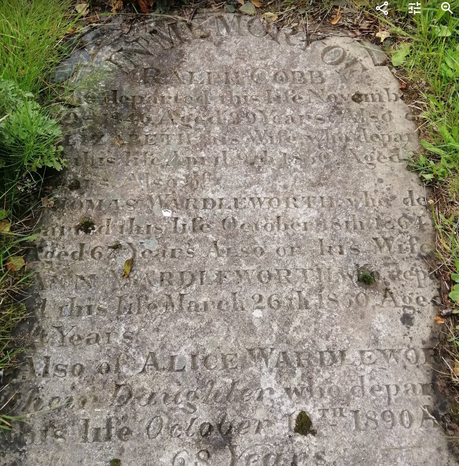
William was succeeded by Thomas and Hezekiah Wardleworth, who carried on the business of turkey red dyers, and were noted for the superiority
and brightness in the colour of the goods which they dyed. The works were then known as Wardleworth's as a result.
The term ‘Turkey red’ applies not to the colour but rather to the process that was used to create the bright and fast red, which came from the country of Turkey. The Turkey red process involved multiple steps, could take weeks to complete and required almost constant attention from the workforce. The main component was madder, a plant root, of which there many varieties but the one most commonly used is called Rubia tinctorum, or ‘dyer’s madder’. A number of other ingredients were also required, including rancid olive oil and sheep’s dung, which were used for oiling and preparing the cloth before it was dyed. During the actual dyeing, the madder extract (alizarin) was combined with bullocks’ blood, though the blood seem to have been more for ‘alchemical’ than any real chemical purpose.[Ref National Museum Scotland]
The 1841 census places the brothers living at Bunkers Hill, alongside six other households with a mix of surnames and occupations from agricultural labourers to weavers, dyers and manglers.
[one of the families was the Thorpe family, with an Issachar Thorpe b:1811]
[TimePix]
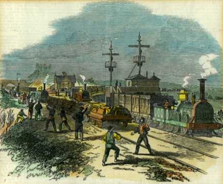
During the railway boom, the Clifton to Accrington railway line was built, involving the construction of Clifton Viaduct (Thirteen Arches) across the Irwell in 1846.
Read about The Battle of Clifton Junction
Bradley Brook, passes down Mere Clough, Dams Head Lodge and the site of Bradley Farm, before dropping into the Irwell at Bradly Wharf, and was the historical boundary between the Manors of Pilkington and Prestwich.
A curious structure appears on the maps of the 1920's, just north along the Pilkington side of the river and it still can be seen today.
This structure stops a high level on the River Irwell from blocking Mere Brook from emptying, thus protecting the Outwood Bleach Works & Waterdale Dye Works from flooding. A similar but less structured feature appears on the 1830's map at Red Rock/Bradley Ford too.
The old Prestwich to Pendlebury Road crossed the River Irwell at
Bradley Ford. This used to be the main pack horse route from Prestwich to Salford and beyond, until the Clifton Aqueduct was built and canal became King. It is presumed that "Clive of India" who was a grandchild of Nathaniel Gaskell of Clifton Hall just over the river, would have crossed this ford to reach his classes at Stand Grammar, and later, his property on Griffe Lane, near Whitefield.
The site of the cottage (tucked in the crook of Bradley Brook, on the far left of the tithe map above) is all but gone, and Mrs Southern died in 1905, buried in St Mary's Churchyard.Today the far bank is a pile of slag from the nearby factories and the Prestwich bank has changed greatly too.
In 1850, the entire Dye works were put up for sale after the death of Hezekiah Wardleworth. Thomas was buried in St Mary's Churchyard, in 1864 and a Hezekiah (the possible relation mentioned above) was buried in 1896.
The works were taken over by Messrs. Drinkwater & Westbrook, bleachers, who were in occupation for only a few years.
By 1902 Messrs. Robert Kay & Sons, bleachers, dyers, and printers occupied the premises some of which stood dilapidated.
Prestwich Rugby Union Football Club was founded in 1921, and during the 1930's rented two fields from Waterdale Dyeing and Finishing Company Ltd. and built a pavilion.
The teams (they managed to raise 3) had a long, uphill walk back home after a match, I just hope they won a few !
Waterdale Dyeing & Finishing Ltd, who employed 300, along with Mere clough Ltd. went into liquidation in December 1955, and Waterdale Works was purchased by Lloyds Packing Warehouses Ltd.
The 155 foot chimney of the Waterdale Dyeing and Finishing Co. Ltd., was built about 1900, and was demolished in 1974. The Company had 220 employees, and had closed in 1970.
Click play to hear the reminiscences of
[with kind permission of Kersalflats.co.uk]
Close by to Dams head Lodge, you can still see the foundations of South Lodge, just through the the white gate towards Philips Park, which along with all the other surviving structures of the Park estate, had been listed Grade II in 1966. It had been the Southern entrance to The Park and by 1966 was occupied by the lady who ran the café in the Quadrangle. The Lodge had no gas, electricity, or running water, and was still lit by oil lamps. The property was demolished in 1974, having been declared a dangerous structure after it had stood empty and vandalised for a number of years.
Also in 1999 a large part of the park and adjacent land at Waterdale was declared the Borough’s first Local Nature Reserve.In 2002 Bury Council entered into a 5-year woodland grant scheme with the Forestry Commission which helped fund thinning work in North and South Woods, repair of retaining walls and the removal of invading sycamores in Mid
Wood.
Now owned and managed by the Forestry Commission, major work has been carried out to stop heavy metals from leaching out of contaminated ground at Waterdale and Drinkwater Park. Thousands of tons of soil have been imported to create a stunning wildflower meadow, while a mixture of deciduous trees were also planted. Many of these are managed traditionally by local coppice workers to produce sustainable products.
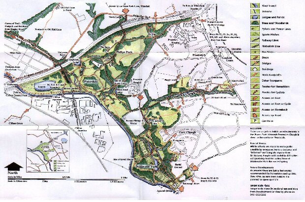
Read a leaflet on Waterdale Park: